13 March 2026
Tom’s Down
Tom’s Down
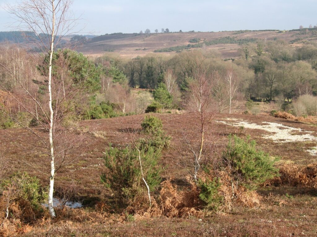
This walk is one of five Historic Routes. This historic trail passes Exbury, The Cadland Estate and on to Fawley. It covers areas used extensively during WW2 and for D-Day preparations. There are several remains of WW2 military installations throughout. There are also sites of old farmsteads, a Roman road, brickworks, mills and gravel pits, as well as ancient woodlands and Sites of Special Scientific Interest (SSSI). The paths are thought to have been used for a variety of activities, including smuggling. The research into this trail was carried out by the NPA with the help of volunteers for the Our Past, Our Future Landscape Partnership Scheme. See the files tabs on the right for a printable leaflet of the walk.
Easy
Tom’s Down
Route
Historic Route
Length
6.0 miles
Duration
3 hours
Points of interest
Select the points on the map to discover highlights along the route, including scenic views, wildlife spots, and places of local interest.
Walk highlights
The Cadland Estate originally consisted of monastic lands and was bought by The Hon. Robert Drummond in 1772. He was sent south from Scotland before the Jacobite rebellion where his father died fighting for Bonnie Prince Charlie. His uncle was the founder of Drummonds Bank where Robert made his wealth.
The original Estate stretched from Hythe pier southwards, but some land at Hythe was sold during the agricultural depression of 1895 and a third of the estate was subject to compulsory purchase in 1947 for the oil refinery north of Fawley. The land for the oil refinery meant the destruction of the mansion house, Capability Brown park, model farm and 40 estate cottages. The mansion was designed by Henry Holland, who also designed Cadland House as the focus of the miniature pleasure gardens created by Capability Brown.
Cadland House was an elaborate Georgian beach-hut-style thatched cottage that burnt to the ground in 1785. The current Cadland House which overlooks the Solent was built in 1935 in the same position as the original cottage. Cadland has had some illustrious visitors including King George III, Queen Victoria and Napoleon III.
The Estate was owned and managed by Maldwin Drummond from 1954 to 2007 and is now owned by his son Aldred. Maldwin was a well-known New Forest figure. He was a former High Sheriff of Hampshire, he served as chairman of the New Forest magistrates and was head of the New Forest Verderers for three years.
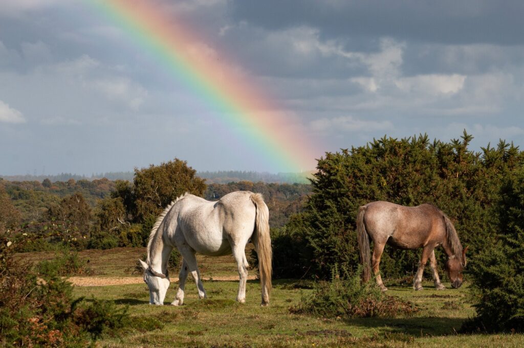
The Verderers of the ancient Verderers’ Court (dating back to the 13th Century) are the guardians of commoners, common rights, and the Forest landscape. They can also make and amend byelaws. Commoners of the New Forest are those who occupy land or property to which are attached one or more rights over the Forest.
There were many wartime installations in the Fawley area, including the storage tanks used for the PLUTO project, a Second World War Pipe Line Under the Ocean. These were located at the end of Badminston Lane in an area generally known as the Common. It was largely open heathland, much like the New Forest, covered with heather and gorse. PLUTO had a sizeable network of storage tanks, pumping stations and pipelines in southern England to ensure an adequate supply of fuel could be pumped to the Allied armies as they advanced across occupied mainland Europe and into Germany.
The tanks measured about 180m by 100m and stood about three or four metres high. They were covered over with soil and sand and then grassed over to conceal their position and purpose. The removal of the sand and gravel left a huge scar on the landscape about a metre deep and required to be camouflaged. This was achieved by lopping off the top 2m of pine trees, positioning them in the manner of plantation trees and securing them in position with wooden pegs and galvanised iron wire. They soon became a local feature as a forest of small dead tree tops.
Badminston Common was used for common grazing land in the 18th Century. Gravel has been extracted from this area for years. The now flooded Badminston gravel pit is a haven for all sorts of wildlife.
Fawley was a hotbed of smuggling three centuries ago. In Sprat’s Down Wood there were several ‘caves’ used by smugglers, which probably consisted of pits with reinforced sides and a capping of timber and earth. There is a story that one of the cottages in the wood was once visited by the local revenue officer, apparently on a social call, as the old couple that lived there regarded him as a friend. However, he turned out to be no friend, for on hearing his heels ring hollow on the flagstones of the floor, he summoned aid and searched until he had found the entrance to the cottagers’ contraband cellar. Friends or no, he soon had them bundled off to Winchester Gaol for the underground room was stuffed full of recently run goods.
Sprattsdown arose to house the families of the construction workers that were brought in to build the Naval Air Station on Calshot Spit during the early 1900s. Construction of the Calshot Airbase started in 1912 and was fully functioning by 1914. Then in 1918, the Royal Naval Air Service and the Royal Flying Corps were amalgamated to form the RAF, and it remained as a base until 1961.
The houses built at Sprat’s Down were no more than wooden shacks and totalled over 40, they even had a little shop that only closed in the late 1970s. One of the conditions imposed on the houses was that when the families moved out, the house had to be demolished and the ground returned to farmland. There are only six houses left now that have survived and were able to be rebuilt.
The route here sits atop an earthwork dam, south of here is Lower Stanswood Mill (formerly Ower Mill). This dam is part of a now much-silted up pond known locally as the Floating Island. This millpond once provided a water reserve for the Mill downstream, the pond was drained in 1866 but features of the pond (its bay and sluice) can still be seen today.
Stanswood is recorded, in the Domesday Book of 1086, as a manor, with a mill and population of 33 households, putting it in the largest 20% of settlements recorded in Domesday. On Milne’s map of Hampshire c1791, it is shown as Ower Mill but all other records have it as Stanswood Mill within Stanswood Manor.
Now a private home, the machinery in this small brick building was removed, the mill leat filled in and its pond drained in 1866. The site of the old millpond is now marshy land known as Floating Island.
South of Badminston Common, northeast of Dean’s Bridge, are the visible remains of some old cob cottages (farmsteads), the remaining lower portions of the walls can still be made out. There is also a small Second World War brick air-raid shelter. The reason for the shelter being here is unclear, only one cottage was still standing and occupied during WW2. Were there other temporary or secret WW2 buildings nearby?
Small dwellings and holdings started to appear on Badminston Common towards the end of the 18th century as encroachments and are shown on the earlier OS maps.
Only one of the houses gained a name. The others were just related to Badminston Common. They were all described as being at Deans Bridge in the 1841 census and either Badminston or Badminston Common in all subsequent censuses. However, the 1901 census lists the westernmost house; ‘our remains’, as the Bog and later references call it Bog Cottage.
The land here has a natural spring, first marked on an Ordnance Survey’s survey undertaken in 1868. It’s likely that the area behind was quite wet, making the farmland very fertile.
The other houses were gone by 1939. Bog Cottage remained occupied by various members of the Saunders family until after 1939 with many of the women described as laundresses and the men as labourers. It was later occupied by the Corner family, renaming the cottage ‘Dingley Dell’, eventually being demolished in the early 1950s after the family had left.
A tale of relief that brings no relief
This is a story about smuggling, and a place called Bog Cottage, which was a simple, thatched, cob house between Badminston Common and Spratt’s Down, on the left of the track going down to Dean’s Bridge. The lower portions of the walls can still be seen, and a brick air raid shelter still stands there.
The last people to live in Bog Cottage were the Corner family. They renamed the place Dingley Dell. Mr Corner earned a living by selling firewood, although this might have been a means of supplementing another income. Mrs Comer is probably the lady in the accompanying photograph (taken by a member of the Mudge family around 1949/1950 and displayed for sale in their shop window). When the Comers left, the roof fell in and the then unprotected cob walls rapidly disintegrated in the rain. A brick privy and a well, together with the air raid shelter, were the most substantial remains of occupation there.
Long ago, according to folklore, the Whitecaps – the Excise men – were sure that a contraband cache existed at Bog Cottage. The area was well known for smuggling activities in the past. Although they searched the house and garden thoroughly, the Whitecaps found nothing. It was thirsty work, and they had refreshed themselves to the extent that one, at least, needed to make water. As he did so, behind a tree, he heard water dripping into a cavity below ground which, on investigation, proved to be stuffed with contraband. The fates of the occupants of Bog Cottage are not recorded.
Now a fishing lake, Mopley Pond was formed sometime in the past by damming the valley where two streams met to form a mill pond for the Mopley watermill on the Bourne. The earliest known reference to a mill here is 1626 but the mill referred to under Woodington in 1555 is almost certainly Mopley. The mill appears on the Fawley tithe map of 1838 but it has been removed by the OS Survey undertaken in 1868.
The PLUTO pipeline ran from the holding tanks on Badminston Common to a pump house at Mopley pond, but was removed after the war. The pump-house was constructed of corrugated iron with a gabled tin roof and double doors in the end, making it look like a domestic garage. Its position near the pond suggests that the water was used to keep the pumping engine cool. The supply of fuel from the storage tanks to the nearby pump house may have been gravity fed, because of the difference in height between the two locations. All that is left today is the concrete base and even this is overgrown with vegetation.
From Mopley to Stone Point on the Lepe foreshore, the Pluto pipeline then ran underwater across the Solent to Thorness Bay on the Isle of Wight and thence across the Island to Shanklin Chine, where it crossed the Channel to the Cherbourg Peninsular.
The lost hamlet of Woodington is recorded in the first detailed description of the Cadland estate in 1379 with 10 tenants. It was part of Stanswood manor, along with Rue, Dean, Field, Cadland and Hythe. By 1555 tenancy had dropped to just six but a mill (Mopley mill) had been established. Woodington slowly disappeared with most of the residents moving to Langley.
a. Eminent archaeologist

Now a modern housing estate, Langley Lodge was once the home of Thomas Edward Lawrence (1888-1935), a British archaeologist, army officer, diplomat, and writer. He lived there with his unmarried parents between 1894 and 1896. The house was then set in private woods between the eastern borders of the New Forest and Southampton Water. The house was isolated, and young Lawrence had many opportunities for outdoor activities and waterfront visits. Guessed who we are talking about? Lawrence of Arabia (image: public domain).
b. Yew tree
Chale Wood is an area of ancient woodland. See if you can spot the old yew tree. Yew is historically significant as the wood was used in the making of the English longbow.
c. Roman occupation
To the east of Dark Water, between the river and Lepe Road is Whitefield Rough. Historic maps show that here was the site of brickworks, kilns and claypits of Whitefield Brickworks on Dark Water. The brickworks seem to have been active during the late 1800s with the stie changing to gravel and sand extraction in the early 1900s. The bricks were used across the whole of the Southern Waterside.
Traveling further back in time to the time of Roman occupation. There is a lot of evidence that the modern Lepe Road from Lepe Country Park to Totton travels on, or very close to, the course of a Roman road. At points along Lepe Rd, where the modern road diverts away briefly, sections of the Roman road can be seen, on various maps and in some cases in the landscape.
Bringing us all the way back to modern times. Where you crossed Lepe Rd. you may not have noticed the layby in front of the farm. This unimposing layby, built of concrete, is a remnant of the important role the New Forest plaid during the Second World War. Hundreds of troops, equipment and vehicles once travelled down this now quiet country lane on their way France on D-Day June 1944. The laybys all along this section of road were to the help manage the immense volume of traffic on way to Lepe and the embarkation hard.
d. Eaglehurst camp
East off Stanswood Road is one of this trail’s branch routes toward the old Power Plant, the coast and the NFNPA walking trail Ashlett Creek to Calshot Spit. Part of this path takes you along Elmfield Lane and to the south was Eaglehurst Camp. Eaglehurst Camp was first built (1917) during the First World War as an ancillary site of RNAS Calshot, built to accommodate the ground staff and sea plane aircraft crews based there. The site was modified in World War II with the addition of defensive trenches and camouflage on the building’s roofs. The camp was connected to RAF Calshot by a light railway (also built in World War I) and by 1940, the camp accommodated 500 trainee airmen.
Eaglehurst was used as an officers Mess during the second world war. Eaglehurst Cottages were occupied by Wrens. There was a road across the field to Eaglehurst camp.
e. Castle view
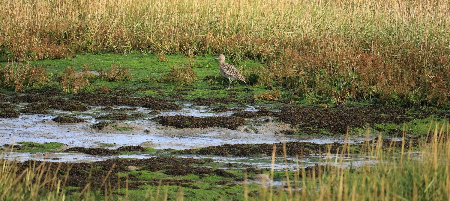
Calshot Marshes is an area of mudflats at the southern end of Southampton Water, that included salterns at the start of the nineteenth century. It forms part of the Hythe to Calshot Site of Special Scientific Interest (SSSI) because of its nationally important numbers of migratory and over-wintering waders and wildfowl. There is a view from the water’s edge across to Calshot Castle built by Henry VIII as part of the Solent defences.

Curlew standing in a marshy tidal flat
1 - 1
The New Forest Code
The New Forest code is a unique place with rare wildlife and free-roaming livestock. Help us care for this special place by following the simple New Forest Code.
New Forest CodePrintable leaflet
You might also like
 Accessible
Lyndhurst Village
 Moderate
Stuckton Iron Works
 Easy
Easy
Rockford Common
 Easy
Easy
Frankenbury Hill Fort
Download our walking app
Our free walking app features points of interest and photographs.