

Rhinefield Ornamental Woodland
Rhinefield Ornamental Woodland
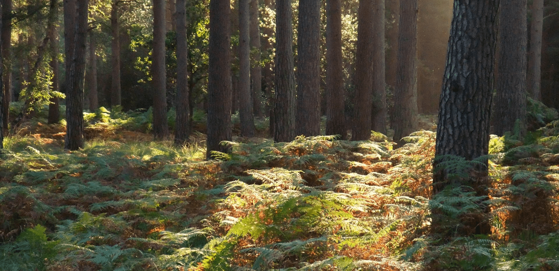
Embarking from Brockenhurst, this cycle takes you through an area of the National Park rich in flora, fauna and history
As you turn onto Rhinefield Road look out for the Bronze Age Barrow on the far side of the road. This is one of thousands of archaeological sites in the Forest, many of which have been catalogued for the first time in recent years by the National Park Authority. Shortly after the barrow are bomb craters on either side of the road created during the Second World War. They are normally easy to spot as water forms puddles in them during wet periods. The Rhinefield area boasts the tallest trees in the New Forest. Some redwoods can stretch up to 50m high! There is a great walking path waymarked under the trees that starts form Blackwater car park, perfect for the return visit. Blackwater car park provides picnic benches and toilets, it is a minor deviation from the route.
Overview
Start/Finish
Brockenhurst Railway Station. Grid ref. SU301020. Postcode SO42 7DW. Finishes in Burley Village
Ordnance Survey map
Explorer OL 22 New Forest
Getting there
New Forest Tour Green and Blue Routes (summer only) or Brockenhurst Railway Station
Distance
10.8 miles (17.4 km)
Duration
2-3 hours
Local facilities
This cycle route has a variety of options to find refreshments in the village of Brockenhurst. Toilets can be found in the centre of the village and at Blackwater car park by making a minor detour (see instructions). Bike Hire is available at Cycle Experience next to Brockenhurst Railway Station.
Accessibility
Mainly off-road gravel cycle tracks and a few well surfaced minor roads.
Percentage off-road for cycling
65 per cent off-road tracks, 35 per cent on road
Directions
Starting at the Railway Station ticket office. Head towards the back of the car park where there is an access gate on the right hand side.
Go through this access gate and turn left onto East Bank Road, and then take the next right down Avenue Road.
At the bottom of Avenue Road, turn left onto Sway Road and continue until you see Brockenhurst Primary School on the opposite side of the road.
At the school turn right, go through the school car park and onto the narrow gravel track (waymarker 233) that takes you through Culverley Green and over a small weir.
The gravel track takes you to Burley Road (waymarker 234) where you carefully take a left and then right, to continue on the gravel path (waymarker 235). Follow this wide gravel track until it ends at Rhinefield road (waymarker 236).
Take a left onto Rhinefield Road. Continue along past Aldridgehill Inclosure on your right. The edges of the road are uneven in places so please take care.
The road becomes wooded on both sides, keep going until you pass Rhinefield House Hotel on your left.
Caution: there is a sharp bend in the road.
Just after the 90 degree bend in the road a small cottage is visible on the left side. Take a turning just before the cottage onto a cycle track (waymarker 241).
The track continues straight ahead (past waymarker 242). Rounding the first right there is a downhill section towards a ford.
Caution: ford may be impassable in very saturated conditions.
(To re-route if necessary, return to Rhinefield Road and continue past Black Water car park until waymarker 248 where you turn onto the off-road track).
Continue up the hill (past waymarker 243 and 244).
Caution: the track crosses over Rhinefield Road (waymarker 245/248).
The gravel track continues through a few turns arriving at a crossroads (waymarker 250). Take a left-hand turn following the track until a gate (waymarker 253).
Toilet stop: if you wish to make a detour to use a toilet or picnic benches, take a right at the crossroads at waymarker 250. To then return to the route come back the same way and continue straight ahead at waymarker 250 until the gate at waymarker 253.
The route opens out with heathland on both sides. Shortly after the woodland resumes, there is a deer sanctuary on your left. After passing this there is another gate (waymarker 254).
Continue along the gravel track (past waymarker 255 and 256). At the next gate (waymarker 257) take the right-hand fork where the track splits at a triangle (waymarker 258). There is another gate to go through.
The gravel track continues (waymarker 259 and 260). At the next T-junction (waymarker 262) take a right turn.
There is another gate to go through (waymarker 263) and then the gravel track crosses the Lymington River and follows the edge of an area known as Black Knowl (waymarker 264).
The gravel track ends at a minor road (waymarker 265). Head straight along this road, round a corner (waymarker 239) and up to Rhinefield Road (waymarker 238 and 237) that leads into Brockenhurst.
Take a left towards Brockenhurst. Follow this road past Forest Park Hotel and continue until there is a ford on the left. Caution: ford can be high in adverse weather, there is a footpath around if needed.
Turn left to travel through ford and through the centre of Brockenhurst Village. At the end of this road take a right up into Brockenhurst Railway Car Park.